

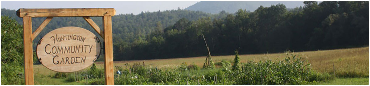


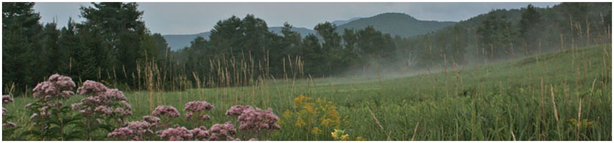

Welcome to the HCC’s Flood Resilience page! Our comprehensive guides cover key topics such as managing invasive species, riparian management, streambank restoration, and strategic planting. These resources are designed to support your efforts in preserving Huntington’s unique riverside environment, protecting your property, and fostering sustainable land stewardship throughout the town. Explore our curated collection to find practical tips and expert advice for building a safer, more resilient future. Let’s work to protect this wonderful community for generations to come!


Informational Resources
- Chittenden County Regional Planning Commission: The Chittenden County Regional Planning Commission is Huntington’s RPC. On top of the federally and state required work they do in transportation improvement and regional planning, the CCRPC has a flood recovery page on their website and is an important resource for smaller municipalities like Huntington.
- Lake Champlain Basin Program: The Lake Champlain Basin Program works to restore and protect the Lake Champlain Basin watershed. The website offers a ‘What you can do’ tab full of resources on how landowners and property managers can improve water quality through ecologically friendly practices.
- Flood Training: This link will take you to an online training provided by Flood Ready Vermont entitled ‘Making Room for Rivers.’ It is a four step training tool to help communities understand strategies to protect their towns from the devastation that floods can bring. While it is geared for residents who hold administrative capacities in their towns, it is still a very useful tool for Vermonters who want to learn more about how to reduce flooding risk by making room for rivers.
- Web Soil Survey: The Natural Resources Conservation Service of the USDA has a powerful online tool that allows you to gather incredible amounts of information about the soil on your property. By locating your Area of Interest on the interactive map, you can learn about the types and health of the soil on your property, which can help you to make informed decisions about plantings. It also includes much more information about vegetative productivity, and soil erosion and chemical properties. They feature a how-to page that walks you through using the interactive map to learn more about your land.
- Flood Ready Vermont: The Vermont Agency of Natural Resources has a state website dedicated to providing resources to Vermonters about flood recovery, resiliency, and prevention. There is information for municipalities as well as community members. If a resident or municipality wants to begin to create a more resilient community, getting acquainted with this website is a great place to start to learn about grant opportunities, read risk assessments on your town, understand more about nature-based solutions, and how to get help.
Contacts
- Streamwise
What they do: Streamwise is an amazing organization that operates in Vermont. Their website provides users with a depth of knowledge and resources on what homeowners can do to create a healthy buffer zone on their property.
Property assessment: Not only does Streamwise offer comprehensive and accessible information online, but they offer a property assessment service. Streamwise can come out to your property and help you identify areas for improvement. After completing a streamwise assessment and meeting all standards, your property becomes “streamwise.”
Contact:
Taylor Litwin: taylor@winooskiriver.org - Friends of the Winooski River
What they do: This non-profit organization works to protect the Winooski river and its watershed. Part of their restoration work is as a partner of Streamwise providing resources and assessments for property owners in the Winooski Basin. They also have a contact page specifically for landowner resources.
Contact:
Michele Braun: michele@winooskiriver.org
Grant Opportunities for Community Resilience
Better Connections Program: This is a state grant sponsored by multiple agencies. The program provides technical assistance and funds to local communities to help them achieve their goals and plan for growth. The program funds planning efforts to increase multi-modal transportation options and to improve land use, water quality, public health, and economic vitality in Vermont communities. Learn more at: https://vtrans.vermont.gov/planning/projects-programs/better-connections.
Better Roads Program: The Vermont Better Roads Program promotes the use of erosion control and maintenance techniques that save money while protecting and enhancing water quality around the state. This grant is designed specifically for projects that are in line with the State’s Clean Water Act (Act 64), therefore funding is prioritized to projects that are providing significant water quality improvements. Learn more at: https://vtrans.vermont.gov/highway/better-roads.
Better Places: is a non competitive, place-based economic development program that works to empower Vermonters to create inclusive and vibrant public places serving Vermont’s designated downtowns, village centers, new town centers, and neighborhood development areas. Better Places uses a unique grantmaking method called “crowdgranting,” which combines crowdfunding and a state matching grant. The program provides one-on one project coaching, local fundraising support, and two to one (2:1) matching grants ranging from $5,000 to $40,000 to make your community-led placemaking ideas happen Learn more at: https://accd.vermont.gov/community-development/funding-incentives/better-places.
The Municipal Planning Grant (MPG): encourages and supports planning and revitalization for local municipalities in Vermont to help breathe new life into communities, plan for future growth and development, and improve the quality of life. Projects that promote Vermont’s historic pattern of compact settlements surrounded by working farms, forest, and open space are given priority. Applications for the Fiscal Year 2025 will open in July 2024. Learn more at: https://accd.vermont.gov/community-development/funding-incentives/municipal-planning-grant. Additional information on the program description can be found at: https://outside.vermont.gov/agency/ACCD/ACCD_Web_Docs/CD/CPR/Funding-and-Incentives/Municipal-Planning-Grant/CPR-MPG_FY24_ProgramDescription.pdf.
Hazard Mitigation Assistance: There are federal programs administered through FEMA that offer funding opportunities to the State of Vermont following a natural disaster. Within these programs, state agencies work to distribute the funds to communities in need and with highest priority projects. In some cases, communities may be eligible to directly apply for funds. If you are considering applying for any of the below funds contact the Vermont Hazard Mitigation Program at Vermont Emergency Management (VEM), where The VEM Mitigation Team can provide support to other state agencies, non-profits, Regional Planning Commissions, and municipalities. VEM also supports regional planners and municipalities in preparing Local Hazard Mitigation Plans (LHMP) and Local Emergency Management Plans (LEMP). https://floodready.vermont.gov/find_funding/hazard_mitigation_assistance#hma
The Hazard Mitigation Grant Program (HMGP) is available after a federally declared disaster. The program assists in implementing long-term hazard mitigation measures and works to significantly reduce or permanently eliminate future risk to lives and property from natural hazards. Towns can also apply for this program to fund the preparation of the local hazard mitigation plan. Learn more at: https://www.fema.gov/grants/mitigation/hazard-mitigation.
Building Resilient Infrastructure and Communities (BRIC) is a program that provides funds for hazard mitigation planning and projects on an annual basis. This fund can support larger projects and is competitive on a national basis. Communities may directly apply. The funds will help state, local, tribal, and territorial governments address future risks to natural disasters, foster greater community resilience and reduce disaster suffering. Learn more at: https://www.fema.gov/grants/mitigation/building-resilient-infrastructure-communities.
The Flood Mitigation Assistance Grant Program (FMA) provides funds for projects to reduce or eliminate risk of flood damage to buildings that are insured under the National Flood Insurance Program (NFIP). It is a competitive program that provides funding to states, federally recognized Tribal governments, U.S. territories, and local governments. FEMA chooses recipients based on the applicant’s ranking of the project, eligibility, and cost-effectiveness of the project. Learn more at https://www.fema.gov/grants/mitigation/flood-mitigation-assistance and
https://floodready.vermont.gov/find_funding/hazard_mitigation_assistance.
The Flood Resilient Communities Fund: The Flood Resilient Communities Fund is a grant opportunity for eligible towns through the Vermont Department of Environmental Conservation and Vermont Emergency management. It was established under Act 74 with the intent of improving landscape and community resilience while reducing climate-related flood hazards in Vermont, focusing on buyouts of flood-vulnerable properties. This is a voluntary program that prioritizes projects in communities and/or for homeowners with greatest economic need and projects that mitigate repetitive loss among low-income and marginalized portions of the population. Projects must reduce future flood risk and must have the co-benefit of improving water quality. Projects for town and/or public infrastructure require that community to have a currently approved Local Hazard Mitigation Plan (LHMP). Funding is limited but applications are encouraged in the event more funding becomes available; the current funding is prioritized to buyout projects after the July 2023 flooding. Learn more at: https://vem.vermont.gov/flood-resilient-communities-fund.
Other Federal Grant Opportunities for Small Cities: The American Flood Coalition has created a guide aimed to help cities with a population of 50,000 or fewer to locate federal grant opportunities they may be eligible for to fund flooding projects. While many of the grants are also targeted to sea level rise, there are many relevant opportunities for Huntington as well. The guide is separated into three categories: infrastructure, environmental restoration, and economic and community development. Learn more about all of the federal opportunities here: https://floodready.vermont.gov/sites/floodready/files/documents/AFC_small_cities_funding_guide_FINAL_042820_20_DIGITAL.pdf.
Invasive Species Resources
- Vermont Invasives Website: This website features a gallery of both land and aquatic invasive plants, as well as a gallery of Vermont’s invasive insects. Here, you can view the native lookalikes of these plants, learn about management options, life cycles, and impacts to the ecosystem.
- Vermont Fish and Wildlife Invasive Plant Page: This website lists information about some of the most common terrestrial invasive plants. Here you can find helpful identification videos, control and prevention methods, and descriptions of their impacts to habitats.
- Landowner Guide to Invasive Plant Assessment: Once you’ve learned how to identify the invasive plants of Vermont, this document will help you complete an inventory and assessment of your property. It will walk you through a step by step process of how to collect information and map the invasives on your property. In order to manage the invasives, you have to know where your problem areas are!
- Invasive Plant Management Options: This document describes nearly all the different options for managing invasives on your land. Here, you can learn about manual removal methods, herbicide, and some other, less common, methods for removal. Note that this resource does not offer management guidance for specific plants, just general descriptions of how to do each method. You can start by referencing the Vermont Invasives Website Gallery to see what management method is recommended, then use this source for additional information to make your removal as successful as possible.
- Mad River Knotweed Project: Folks in Warren, Waitsfield, and Fayston have been working to remove knotweed along stream banks along the Mad River for almost four years. This group completes their work without using herbicide and hosts weekly volunteer work days. This is a link to their instagram to learn more about their work and volunteering with them. If interested in learning more, you can email ashleycray01@gmail.com.
Tree Planting Resources
Vermont Lake Wise Program Native Plant List
A chart full of planting recommendations based on soil type, bloom time, sun preference and growth rate.
Vermont Tree Selection Guide
An in-depth guide that will help you decide what trees are right for you based on your site conditions and goals. It will also walk you through how to maintain the tree’s health after planting.
Tree Selection Tool
The Vermont Urban and Community Forestry Program has a an online tool that allows you to input your site conditions and will provide you with a list of trees that meet your specifications.
Tree Owner’s Manual
This is an incredibly in-depth guide that includes everything from getting a tree ready to be planted, maintaining the tree’s health, and how and when to prune.
Trees Species for Riparian Planting
This is another detailed chart by Vermont Fish and Wildlife that provides species to plant based on your planting location, as well as a list of nurseries that sell young trees